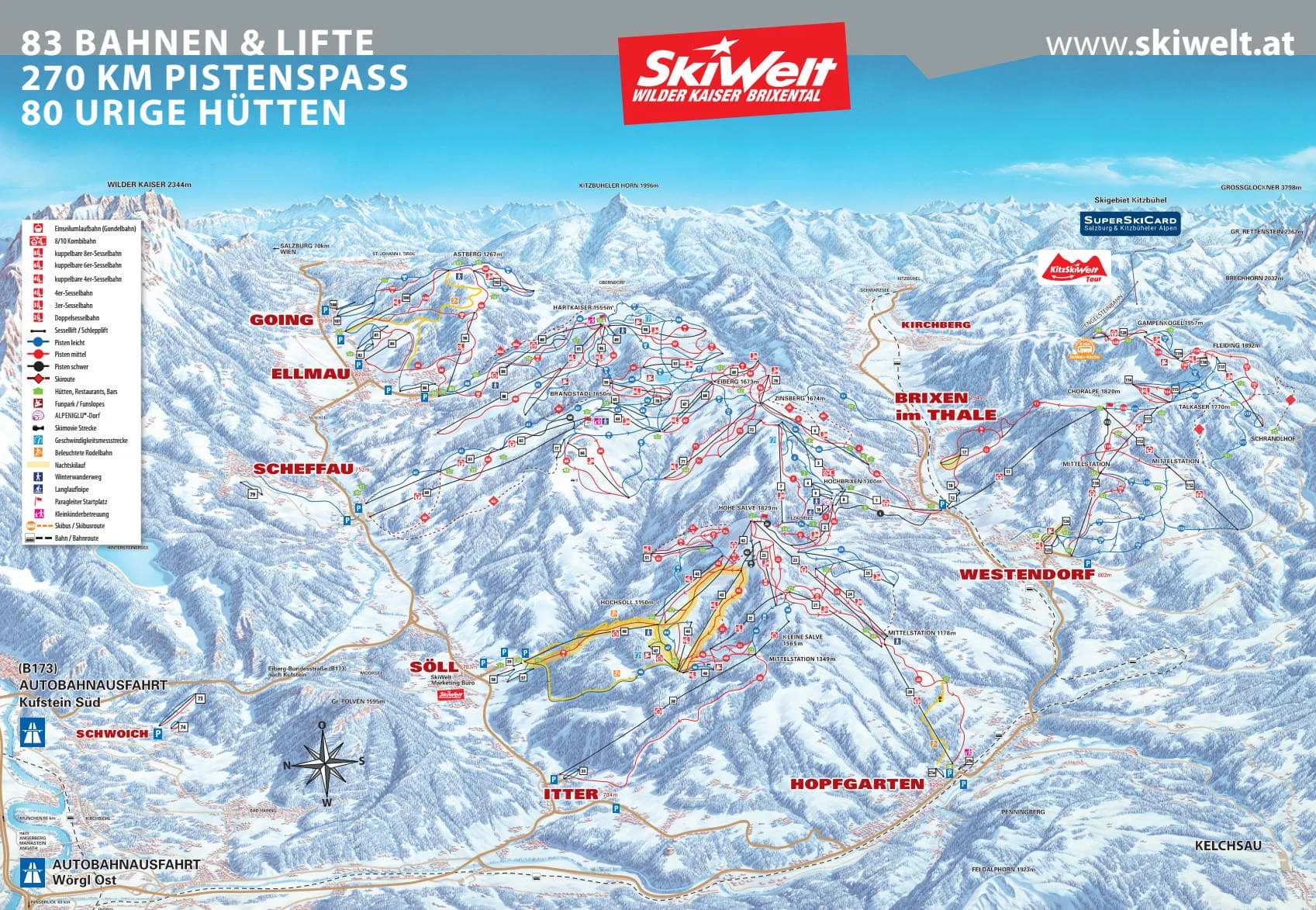

Nestled within the expansive SkiWelt Wilder Kaiser-Brixental, one of Austria's largest interconnected ski areas, Westendorf offers a diverse range of pistes that cater to skiers and snowboarders of all skill levels—from gentle beginner areas to challenging runs for seasoned enthusiasts. As you plan your journey to this delightful Alpine destination, be sure to download the latest Westendorf piste map. This essential guide provides a comprehensive overview of the area’s extensive network of trails, highlighting ski lifts, slope difficulties, and seamless connections to neighboring resorts within the SkiWelt region.
Download it here, or pick up a copy at ticket offices and information points throughout the Westendorf ski resort.

Download the latest Westendorf, SkiWelt piste map
Mayrhofen - Niederau - St. Anton - Saalbach - Sölden - Kitzbühel - Kaprun - Kaltenbach - Ischgl - Serfaus - Tux - Wagrain - Zell am Ziller - St Johann im Pongau - Lech Zürs - See - Grossarl - Maria Alm - Gerlos - Flachau - Galtür - Ellmau - Scheffau - Söll - Going am Wilden Kaiser - Bad Gastein - Bad Hofgastein - Kleinarl - Obergurgl - Zell am See