
Situated in the stunning Bernese Oberland, Gstaad offers a variety of pistes that cater to all levels, from serene beginner slopes to challenging terrain for seasoned skiers. As you plan your escape to this exclusive winter wonderland, ensure you download the latest Gstaad piste map. This indispensable guide thoroughly maps the sprawling network of trails, showcasing ski lifts, slope difficulties, and the connections to smaller surrounding ski areas.
Download the latest Gstaad piste map, or pick up a copy at ticket offices and information points throughout the resort.


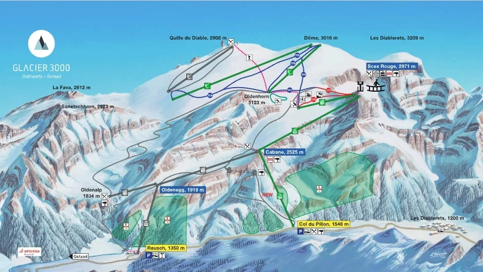
At the summit of the Gstaad ski area, the Glacier 3000, that peaks at over 3,000 meters, provides a year-round skiing opportunity. Click on the links below to download the latest Gstaad-Glacier 3000 piste map.
Zermatt - Verbier - St. Moritz - Grindelwald - Crans-Montana - Davos - Saas Fee - Nendaz - Engelberg - Arosa - Laax