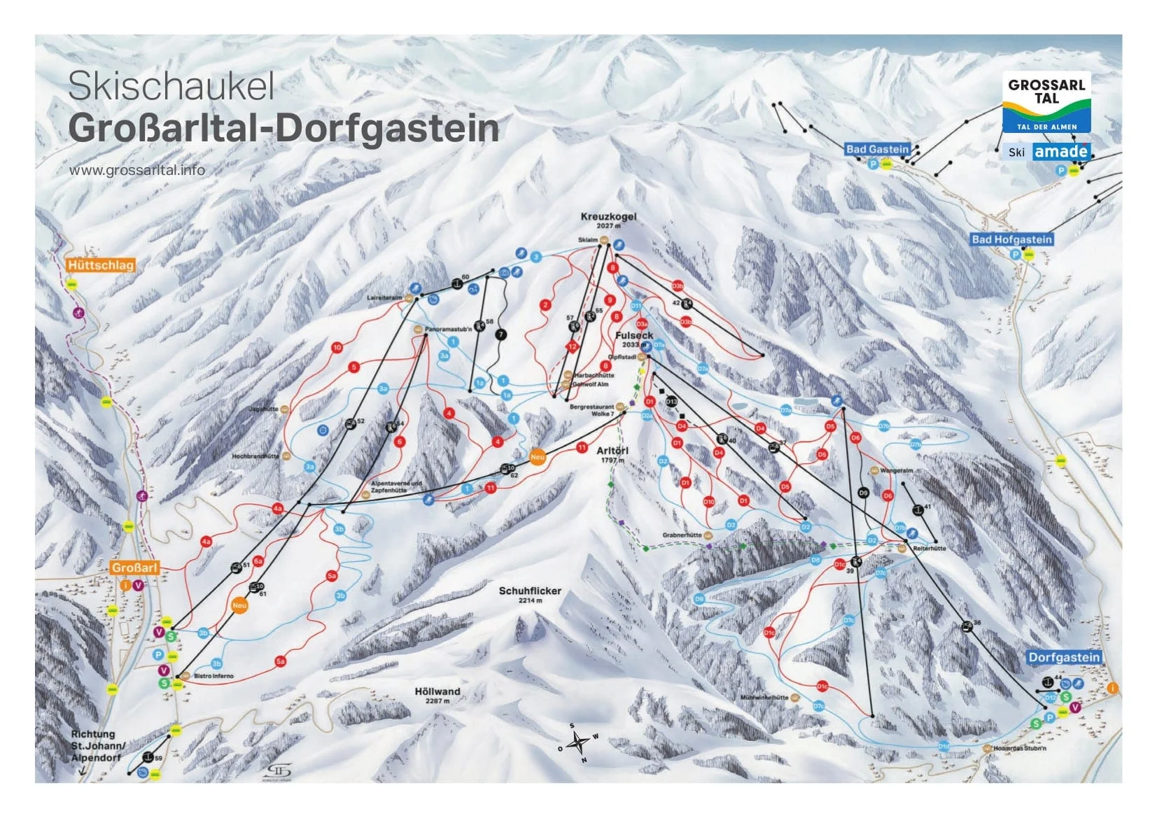

The Großarltal ski area, which includes the charming villages of Dorfgastein, Grossarl, and Hüttschlag, offers over 67 km of pistes. Download the latest Großarltal piste map and get valuable information on the ski area's popular ski runs, and extensive ski lift network to make the most of your ski holiday time.
Plan your ski holiday ahead with our detailed piste map. Download it here, or pick up a copy at ticket offices and information points throughout one of the many Großarltal ski resorts.

Download the latest Großarltal/Dorfgastein piste map
Mayrhofen - Niederau - St. Anton - Saalbach - Sölden - Kitzbühel - Kaprun - Kaltenbach - Ischgl - Serfaus - Tux - Wagrain - Zell am Ziller - St Johann im Pongau - Lech Zürs - See - Grossarl - Maria Alm - Gerlos - Flachau - Galtür - Ellmau - Scheffau - Söll - Going am Wilden Kaiser - Bad Gastein - Bad Hofgastein - Kleinarl - Obergurgl - Zell am See