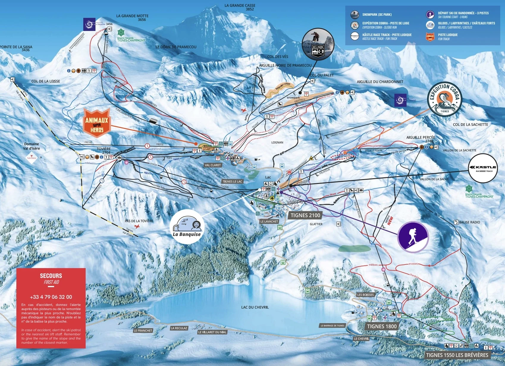

Perched in the Tarentaise Valley of the French Alps, Tignes is part of the famed Espace Killy ski area, renowned for its extensive and challenging terrain that attracts both professional and recreational skiers from around the world. Before you set off to conquer the slopes, ensure you have downloaded the latest Tignes piste map. This crucial tool provides a comprehensive overview of the area’s vast network of pistes, detailing the various levels of difficulty, the locations of key lifts, and the connections to neighboring Val d'Isère. The map also includes important amenities such as restaurants, service points, and relaxation zones.
Download the latest Tignes piste map, including the snowpark, sledge runs, fun tracks, and ski touring starting point or pick up a copy at ticket offices and information points throughout the resort.


At the summit of the Tignes ski area, the Grande Motte glacier, which stands at an altitude of nearly 3,656 meters, offers 20 km of skiable terrain. This provides the unique opportunity to ski during the summer months of June, July, and August. Click on the links below to download the latest Tignes-Grande Motte Glacier piste map.
Val Thorens - La Plagne - Chamonix - Tignes - Avoriaz - Val d'Isère - Méribel - Les Arcs - Les Menuires - Courchevel - Flaine - La Clusaz - Serre Chevalier - Samoëns - La Rosière - Montgenèvre - Val Cenis - Megève - St Martin de Belleville - Isola 2000 - Risoul - Valmorel - Les Gets - Morzine - Les Deux Alpes - Alpe d'Huez - Vaujany - Sainte Foy Tarentaise - Saint Gervais les bains - Châtel - Les Houches - Les Sybelles - Les Carroz - Les Contamines-Montjoie - Les Orres - Les Saisies